What Happens If The Oceans Keep Getting Hotter? The Future Of Sea Levels, Hurricanes And The World’s Coastlines
Hotter Oceans Are Raising The Stakes For Every Coastline
The Ocean Can Store A Climate Crisis Long Before A Coastline Looks Different.
If the oceans keep getting hotter, the consequences extend far beyond warmer swimming water. Seawater expands, marine ecosystems face greater heat stress, and a higher coastal water level gives storms a more dangerous starting point. Tropical cyclones can draw energy from warm water, while changes in the ocean affect food, livelihoods and infrastructure across the world.
The outcome is not that every coastal city suddenly disappears beneath a single advancing line. Flooding, erosion, saltwater intrusion and disruption arrive differently in different places. Some communities can adapt effectively; others face difficult limits. Future emissions matter because they influence how much additional warming and sea-level rise must eventually be managed.
The Guardian reported on 30 September 2026 that the ocean gained 23 zettajoules of heat in 2025. That enormous quantity is best understood as an energy measurement, not a direct forecast for the height of water outside a particular house. The lasting story is how stored heat changes the physical conditions on which coastlines and human settlements depend.
Why The Ocean Absorbs So Much Heat
The ocean covers most of Earth's surface and has an enormous capacity to store energy. NASA estimates that it has absorbed about 90 per cent of the excess heat associated with planetary warming over the past century. That has moderated atmospheric warming, but the energy has not vanished. It has entered a vast, moving reservoir.
Water requires considerable energy to change temperature. A modest change averaged across a large volume can therefore represent an enormous accumulation of heat. This is why a global ocean-temperature increase that sounds small in degrees can still be climatically significant. The size of the reservoir is part of the calculation.
The heat is not distributed uniformly. Winds, currents, mixing and interactions between the ocean and atmosphere influence where it accumulates. Conditions at the surface can differ from those farther below. A map of exceptionally warm surface water and a measurement of total ocean heat content answer related but different questions.
Nor does a cooler week at one beach contradict long-term ocean warming. Local weather and circulation can temporarily change the water people experience. The global trend is assessed from observations across space, depth and time, rather than from one thermometer or one holiday.
What A Zettajoule Does And Does Not Tell Us
A joule is a unit of energy. A zettajoule is one sextillion joules, written as one followed by twenty-one zeros. Twenty-three zettajoules therefore means 23 × 10²¹ joules. The number is difficult to picture because everyday experience gives us little intuition for the energy budget of an entire planet.
A useful calculation converts an annual energy gain into an average rate. Dividing 23 × 10²¹ joules by the 31,536,000 seconds in a 365-day year gives approximately 7.29 × 10¹⁴ watts, or 729 terawatts. This is an illustrative conversion of the stated annual figure, not a measurement of an electrical power supply that can be captured.
The distinction matters. Thermal energy spread through seawater is not equivalent to electricity delivered through a cable. Comparisons with human energy consumption convey scale, but they can mislead if readers imagine a readily usable reserve or a single sudden burst.
A heat-content figure also requires a measurement definition. Researchers may examine different depths, baselines and observing systems. Before comparing two published estimates, check whether they concern the same layer of the ocean and the same period. A difference in definition is not automatically a scientific contradiction.
How Scientists Observe A Moving Ocean
Ocean observations combine methods because no single instrument measures everything. Satellites can observe aspects of the sea surface, while instruments in the water provide information below it. Repeated measurements are needed to distinguish longer-term change from the natural movement of heat between regions and depths.
An observation programme faces practical gaps. Storms, sea ice, depth and remoteness make some areas harder to sample than others. Scientists use quality control and statistical methods to create coherent estimates, and the uncertainty attached to a result reflects more than whether a thermometer is accurate.
For a reader, a good report should explain the quantity measured, the time span, the comparison baseline and the uncertainty. A record claim should identify which record it refers to. A record surface temperature, record heat content and record annual increase are different statements, even if they occur in the same warming climate.
These distinctions protect the core finding from unnecessary exaggeration. Ocean warming does not become less important because its measurement is technical. Careful definitions make it possible to understand what has changed and to compare observations with projections.
Why Warmer Water Raises Sea Level
One mechanism is thermal expansion. When seawater warms, its volume generally increases under the relevant ocean conditions. The same mass of water then occupies more space. NASA identifies expansion as a major contributor to observed sea-level rise, alongside water added from land-based ice.
The second mechanism involves glaciers and ice sheets. Ice that was resting on land adds water to the ocean when it melts or flows into the sea. Floating sea ice behaves differently: its direct contribution to sea level is much smaller because it already displaces seawater. Losing it can still have important climatic and ecological consequences.
Ocean heat can also affect the edges of ice sheets by interacting with floating ice shelves. The wider response is complex and depends on geography and ice dynamics. It is one reason projections cannot be reduced to a simple rule saying that each extra unit of ocean heat produces a fixed rise everywhere.
The processes operate on different timescales. A warm season can alter local conditions quickly; deep-ocean adjustment and ice-sheet change can continue much longer. Stabilising atmospheric temperature therefore does not mean that sea level immediately stops changing.
What The Sea-Level Projections Actually Say
The Intergovernmental Panel on Climate Change's Sixth Assessment synthesis gives a likely global mean rise by 2050 of 0.15–0.23 metres under a very low emissions scenario and 0.20–0.29 metres under a very high emissions scenario, relative to 1995–2014. The overlapping ranges show why adaptation is necessary even with strong emissions reductions.
By 2100, the same assessment gives likely ranges of 0.28–0.55 metres under very low emissions and 0.63–1.01 metres under very high emissions, again relative to 1995–2014. These are scenario-dependent projections, not a single countdown or a claim that every coast rises by the same amount.
A baseline is essential. These figures are not all additional rise from the day this article is read. They use a specified historical reference period. Comparing a local forecast with a global number without checking their baselines can produce a seriously misleading impression of the remaining change.
Nor is the upper end of a likely range a physical ceiling. Planning for long-lived, high-consequence infrastructure may need to consider less likely but more damaging outcomes. That is a risk-management decision, not permission to present an extreme scenario as the expected future.
Why A Few Centimetres Can Matter Before A Metre Arrives
A flood barrier, road or drainage outlet operates in a particular physical setting. Water does not need to rise by metres before it crosses an existing threshold more often. A modest change in the background level can turn an occasional nuisance into a recurring disruption when tides and weather add their own temporary rise.
Consider an illustrative coastal road that sits only slightly above a high-tide water level. A further rise does not distribute its inconvenience evenly across every day. It can sharply increase the number of occasions on which the road becomes unusable, especially when high tides coincide with onshore winds or storm conditions.
This is why average sea level and flood frequency must be considered together. A small shift in the average can have a large effect near a threshold. The same logic applies to drains that lose the ability to discharge freely, or underground spaces that become vulnerable before the surrounding streets are permanently submerged.
There is no universal conversion from centimetres to annual flood days. Local elevation, tides, waves, defences and drainage determine the result. Useful assessments use those local conditions rather than simply placing a global average on top of a map.
Will Coastal Cities Be Underwater?
Some low-lying places face increasing risks of permanent inundation, but the phrase “cities underwater” often compresses several different problems into one dramatic image. A city can become more expensive, less reliable and more difficult to inhabit while most buildings remain above the ordinary waterline.
Repeated flooding can interrupt transport, damage electrical equipment, contaminate water and close businesses. Salt can affect soils and freshwater supplies. Erosion can remove the ground in front of a property even where its floor is above the predicted flood height. Habitability depends on functioning services, not just on whether a roof remains visible.
Relative sea level also includes movement of the land. Subsidence can worsen local exposure, while uplift can partly offset it. Groundwater extraction, sediment processes and geological change can therefore matter alongside the global ocean trend. Two cities at similar elevations may face different trajectories.
Maps that fill all land below a chosen height can be useful illustrations, but they are not complete flood forecasts. They may omit barriers, pumping, connections to the sea, waves or future adaptation. A responsible assessment explains those assumptions before claiming that a named neighbourhood will disappear by a particular year.
Warmer Oceans And Hurricanes: The Important Distinction
Tropical cyclones draw energy from warm ocean water, but water temperature alone does not determine whether a storm forms or intensifies. Atmospheric moisture, wind shear, circulation and the structure of the storm also matter. Warm water can create a favourable ingredient without supplying every other condition.
The difference between storm frequency and storm intensity is especially important. A world with more damaging intense storms does not necessarily have more storms overall. Counting named systems in a single season therefore cannot settle the wider climate question.
Ocean conditions below the surface can matter too. A storm churns the sea as it passes. If that mixing brings much cooler water upwards, it can limit the available energy. Where warm water extends deeper, the storm may encounter a different energy supply. Surface temperature alone is consequently an incomplete description.
For coastal communities, hazard is not limited to the peak wind speed. Rainfall, storm surge, waves, the timing of high tide and the duration of exposure all contribute. The same storm category can accompany very different flood consequences in different locations.
Expert Perspective: Stronger Storm Risk Is Not A Simple Storm Count
Tom Knutson, a senior scientist at NOAA's Geophysical Fluid Dynamics Laboratory, maintains a detailed assessment of global warming and hurricanes. The research synthesis supports increased tropical-cyclone rainfall and a greater proportion of very intense storms under warming, while treating changes in total storm frequency more cautiously. That separation is central to interpreting the evidence.
This is an attributed summary of published scientific work, not a bespoke forecast or an interview for Taylor Tailored. It helps explain why the honest headline is more specific than “hotter seas mean more hurricanes”. The distribution of storm strength and the amount of rain can change even where the total number does not increase.
The practical implication is to plan around the hazards that actually affect a community. A place vulnerable to extreme rainfall needs more than a wind-resistant roof. A place exposed to surge needs more than a count of past landfalls. Climate information becomes useful when it meets local geography and engineering.
Why Storm Surge Starts From A Higher Platform
Storm surge is a temporary rise in coastal water driven principally by a storm's winds and pressure, shaped by the coast and seabed. Sea-level rise changes the background on which that surge occurs. A familiar storm can therefore produce a different total water level when the baseline is higher.
Several hazards can coincide. Heavy rainfall may send water towards the coast just as elevated seawater makes drainage harder. Waves can run up above the still-water level and strike structures. A flood calculation that treats each process separately may miss the difficulty created by their timing.
For an illustrative household, the distinction between seawater entering through a doorway and rainwater backing up through drainage may matter for repairs and prevention. Both can accompany the same coastal event. Identifying the route of water is more useful than assuming every flood has a single cause.
Adaptation must therefore consider whole systems. Raising one wall may protect a frontage while leaving access roads, drains or neighbouring areas exposed. The protective value of a project depends on how it fits the surrounding landscape and infrastructure.
A Reef Under Pressure. AI-generated conceptual editorial illustration; not documentary photography.
Marine Heatwaves Can Damage Life Below The Surface
A marine heatwave is a period of unusually warm ocean conditions relative to the local seasonal expectation. The term describes an anomaly, so a heatwave in a normally cold region need not resemble tropical water. Duration and the affected depth help determine its ecological effects.
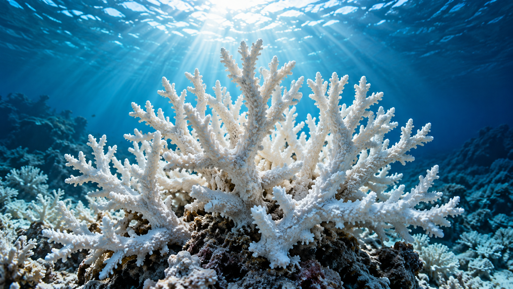
Corals are a visible example of heat stress. Many reef-building corals live in a close relationship with microscopic algae. Stress can disrupt that relationship and cause bleaching. Bleached coral is not automatically dead, but prolonged or repeated stress can reduce survival and make recovery harder.
NOAA's coral guidance identifies warming as a major threat and distinguishes bleaching from other pressures on reefs. A reef's outcome depends on the severity and duration of exposure, local conditions and the time available for recovery. A dramatic pale reef photograph cannot by itself establish how much coral has died.
The wider issue extends beyond coral. Species have different tolerances and can respond by moving, changing their seasonal activity or declining where conditions become unsuitable. Those changes can alter ecological relationships rather than simply shift every species northwards together.
Ocean Acidification Is A Related But Different Problem
Warming and acidification often appear in the same discussion because both are connected to human emissions, but they are not the same process. Ocean acidification principally results from the chemistry of seawater absorbing carbon dioxide. It does not mean the sea becomes an acid in the everyday sense of a liquid with a pH below seven.
Changes in seawater chemistry can make it harder for some organisms to build or maintain calcium-carbonate structures. NOAA's explanations of ocean acidification highlight the importance of carbonate availability for corals and shell-forming species. Responses vary, and the ocean's ecology cannot be represented by a single universal sensitivity.
Separating the mechanisms improves the choices available. Cooling a particular location would not automatically remove the extra dissolved carbon dioxide. Equally, a short-lived temperature fluctuation does not describe the longer-term chemistry. Monitoring needs to address both.
Combined pressures can be especially difficult for ecosystems already affected by pollution, habitat damage or heavy exploitation. Reducing local stress may improve resilience, even though it cannot substitute for addressing the global drivers. A useful response works at both scales.
Fish, Food And Livelihoods Follow The Water
Changes in marine conditions can influence where species are found and how productive a fishery becomes. NOAA Fisheries describes shifts in distribution and ecosystem effects among the consequences of climate change. For a coastal economy, the relevant issue is whether the species, infrastructure and access arrangements on which people depend still align.
A fish moving into a new area does not automatically create a usable replacement industry. Boats, equipment, processing facilities and local knowledge may be tailored to different species. Regulations and management boundaries can also lag behind environmental change. A physical shift can therefore become an economic and institutional problem.
There can be opportunities in some places, but they are unevenly distributed. A community that loses a familiar fishery may not have the capital or access needed to exploit a new one. Describing every movement as either total collapse or effortless adaptation overlooks those practical constraints.
For consumers, global supply chains may initially hide local disruption. Seafood can arrive from elsewhere, while the cost is borne by a particular fishing community. Understanding ocean change requires following the livelihood as well as the supermarket shelf.
Why The Future Is Not One Straight Line
Natural variability continues within a warming climate. Ocean-atmosphere patterns redistribute heat and influence conditions from year to year. A period of slower surface warming in one region does not necessarily mean the whole ocean has stopped gaining energy, just as a particularly hot year should not be projected forward at an identical annual pace.
This distinction separates a trend from its short-term expression. Long-lived infrastructure needs to account for both the changing background and the range of conditions around it. A design that assumes every future year resembles the last can fail even without an abrupt climatic surprise.
Future emissions pathways also diverge. The choices that influence long-term warming do not cancel the need to adapt to changes already under way. Conversely, the fact that some further rise is expected does not mean emissions reductions are futile. The scale of the eventual challenge remains consequential.
There is a temptation to ask for a precise year when a coast becomes unsafe. Often the better question is which threshold matters: flood frequency, drinking-water quality, road access, maintenance cost or emergency response. Different thresholds can be crossed at different times.
Holding The Coastal Line. AI-generated conceptual editorial illustration; not documentary photography.
What Coastal Adaptation Can Achieve
Adaptation can involve protecting a location, changing how it is used, accommodating occasional water or moving vulnerable activities. The appropriate mix depends on the coastline, the assets at risk and the resources available. There is no universal engineering solution that fits a dense port, a sandy village and a small island equally well.
Hard defences can reduce exposure in suitable settings, but they require maintenance and can have effects elsewhere along the coast. Nature-based measures such as restoring suitable wetlands or dunes can provide benefits where conditions allow. Neither category should be presented as universally sufficient or universally misguided.
Buildings and services can also be adapted. The value of a measure depends on the actual flood route and the consequences of failure. Protecting a building while leaving its power supply, transport access and water infrastructure vulnerable may preserve the structure without preserving its function.
Some choices require difficult conversations about retreat. Moving is not simply a technical calculation: it concerns homes, identity, employment and fairness. Delaying the discussion can leave fewer options, but imposing a plan without meaningful participation can create its own serious harm.
The Hidden Question Is Who Pays
Two neighbourhoods facing similar physical exposure may have very different capacities to respond. One can fund improvements and absorb disruption; another cannot. Risk therefore includes the resources available before, during and after an event, not just the predicted water level.
Public spending decisions also involve distribution. Protecting one commercially important location may be justified on infrastructure grounds, while smaller communities feel neglected. A transparent assessment needs to explain whose benefits are counted and whose costs remain outside the calculation.
For households, a changing coast can affect decisions about repairs, moving and long-term commitments. Those decisions require local evidence and, where relevant, qualified professional advice. A global climate article cannot determine the safety or value of a particular property.
The same limitation applies to sensational lists of doomed cities. They attract attention but often flatten differences in defence, elevation, subsidence and adaptation. A more useful question is how a city's essential systems will function under a range of plausible conditions.
How To Read A Coastal Risk Claim Without Being Misled
Begin with the place and the baseline. Is the claim about global mean sea level or local relative sea level? What historical period is the rise measured against? Does the map show permanent inundation, an extreme tide, a storm event or an illustrative water height?
Next look at time and scenario. A projection for 2100 under high emissions is not a forecast for next summer. A low-likelihood stress test is not the central estimate. Both may be useful, but they serve different planning questions and should not be silently exchanged.
Then inspect the assumptions about defences and land. Does the analysis include existing barriers, drainage and subsidence? Does it assume no future action? Is the terrain model detailed enough for the claim being made? Small differences in local elevation can matter greatly near a threshold.
Finally ask what consequence is being described. A flood hazard is not the same as a prediction of deaths, permanent abandonment or economic collapse. Those outcomes also depend on warning, planning and adaptation. The strongest explanation follows the chain rather than jumping straight to the most dramatic endpoint.
A Coastal Town Is A Network, Not A Row Of Buildings
Consider a hypothetical town whose main shopping street sits above the projected flood level. It might appear relatively secure on a simple elevation map. But its access road, electricity substation and wastewater facilities could sit lower. If those services fail, the higher street may remain physically dry while businesses still have to close.
This is a useful way to think about second-order effects. A coastal hazard can interrupt a network at a point different from the place where people experience the loss. A hospital's resilience includes staff access, power, supplies and communication, not simply the height of its entrance.
The same reasoning applies to ports. A protected quay does not ensure an uninterrupted trade route if connecting roads, rail lines or warehouses are exposed. Local adaptation plans should therefore examine dependencies and recovery times. Counting protected buildings alone can miss the most important source of disruption.
For residents, this changes the questions worth asking. Can emergency vehicles reach the area during a flood? Is there a reliable route out? Which services have backup arrangements? These practical details may be more informative than a dramatic image showing a distant future waterline.
Planning Can Use Thresholds Instead Of Pretending To Know Everything
A long-term plan does not have to choose one forecast and refuse to reconsider it. It can identify decisions that are useful across several scenarios, then define the observations that would trigger another stage. This is an editorial description of a planning approach, not a prescription for any particular coast.
For example, maintaining drainage and improving warning arrangements may be worthwhile now, while a larger defence decision depends on observed changes in flood frequency, asset condition and updated projections. The plan should say what will be monitored and who is responsible for acting when the threshold is reached.
Waiting is not cost-free. Some projects require years of design, consultation and construction, so a trigger must leave enough time to respond. Equally, committing to an inflexible structure can constrain later options. The choice is between different forms of risk, rather than between certainty and uncertainty.
Public communication benefits from the same clarity. A community can be told what the present evidence supports, what would change the assessment and when the decision will be revisited. That is more useful than alternating between reassurance and catastrophe whenever a new annual record appears.
The underlying point is that uncertainty does not prevent action. It shapes the kind of action that is sensible. Measures that preserve options and protect essential functions can be valuable even when the exact rate of future local change remains uncertain.
What Can Still Be Changed
The ocean responds slowly enough that some consequences continue beyond the moment emissions fall. That delay can make action feel unrewarding if the expected result is an immediate reversal. But avoiding additional heat still changes the scale of the problem that future communities will inherit.
Adaptation and emissions reduction address different parts of the challenge. Adaptation reduces exposure and vulnerability to conditions that occur. Emissions reduction limits the growth of the underlying pressure. Treating either as a complete substitute for the other leaves a gap.
Better observation matters too. Reliable measurements, accessible local assessments and honest communication can improve decisions before an emergency. They help distinguish a genuine change in risk from an attention-grabbing claim and allow plans to be revised as evidence develops.
The ocean's stored heat is a warning with a long timescale. Its consequences arrive through water levels, weather, ecosystems and infrastructure, often before a familiar coastline looks radically different. The meaningful choice is how much additional pressure to create and how well to prepare for the changes already approaching.
Sources And Further Evidence
The Guardian, 30 September 2026 — brief attributed ocean-heat news peg
Copernicus Marine — Ocean State Report collection and methodology context
IPCC AR6 Synthesis, Figure 3.4 — scenario-dependent sea-level ranges and baseline
NOAA/GFDL, Tom Knutson — hurricanes, warming and distinctions between frequency and intensity
NOAA Fisheries — climate effects on marine ecosystems and fisheries
