
The Biggest Tsunamis in History and Their Lasting Impact
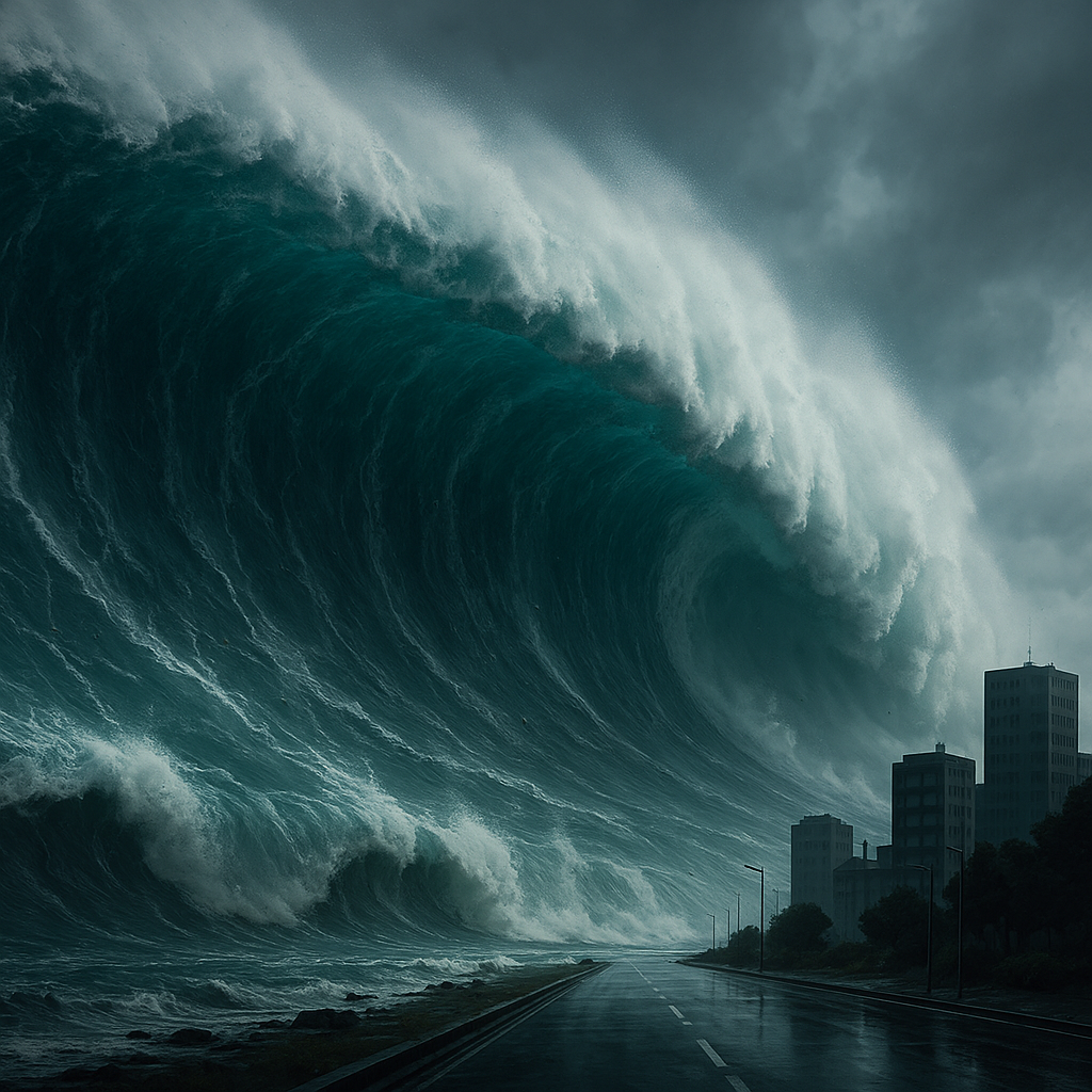
In a matter of minutes on 26 December 2004, entire coastlines around the Indian Ocean were torn apart. Waves up to 30 meters high raced ashore, killing around 230,000 people and making the event the deadliest tsunami in recorded history.
Seven years later, a giant wave struck Japan’s Tohoku region, not only devastating communities but triggering a nuclear crisis at Fukushima.
More recently, in January 2022, an underwater volcano near Tonga exploded with such force that its shockwave reached the edge of space and generated tsunami waves across the Pacific. And in July 2025, a major earthquake off Russia’s Kamchatka Peninsula set off a Pacific-wide tsunami alert; this time, early warnings and evacuations meant limited loss of life.
These events highlight a key point: “biggest” can mean different things. Some tsunamis generate the tallest waves ever measured. Others kill on a vast scale, or travel across entire ocean basins. This article looks at the largest tsunamis in history by height, energy, and human impact, explains the science behind them, and explores how modern technology is reshaping tsunami risk.
By the end, the reader will understand how tsunamis form, what made certain events uniquely destructive, and why advances in satellites, seafloor sensors, and global warning systems are changing the odds of survival.
Key Points
Tsunamis are long-wavelength sea waves caused by sudden displacement of water, usually from major earthquakes, volcanic eruptions, or landslides, and can cross entire oceans at jet-liner speeds.
The deadliest tsunami on record is the 2004 Indian Ocean event, which killed roughly 230,000 people across more than a dozen countries and spurred a revolution in early warning systems.
The tallest tsunami ever recorded struck Lituya Bay, Alaska, in 1958, with a wave run-up of about 524 meters, but the remote location meant only a handful of casualties.
Major historical tsunamis from events like the 1755 Lisbon earthquake, the 1883 Krakatoa eruption, the 1960 Chile earthquake, and the 2011 Tohoku earthquake reshaped cities, economies, and even philosophies about risk and natural disasters.
Since 2004, a network of deep-ocean sensors, satellites, and regional warning centers has dramatically improved detection and lead times, but exposure of coastal megacities and small island states keeps overall risk high.
New observations of the 2025 Pacific-wide tsunami from space are forcing scientists to refine models of how tsunami waves behave in the open ocean, with implications for future forecasting.
Background
A tsunami is not a single breaking wave but a train of waves generated when a large volume of water is displaced, usually suddenly. Unlike ordinary wind-driven waves, which have short wavelengths and affect only the upper layer of the ocean, tsunamis involve the entire water column from seafloor to surface. That is why they can travel at hundreds of kilometers per hour across deep oceans with only modest surface height, then rise into towering walls of water as they approach shallow coasts.
Over the past century, tsunamis have killed more than 260,000 people worldwide and caused losses measured in the hundreds of billions of dollars. Most of this toll comes from a small number of extreme events:
The 2004 Indian Ocean tsunami, triggered by a magnitude 9+ megathrust earthquake off Sumatra, sent waves up to 30 meters high into coastal communities and killed well over 220,000 people.
The 2011 Great East Japan (Tohoku) tsunami followed a magnitude 9.0 earthquake off Honshu, leading to nearly 20,000 deaths and severe damage, including to a nuclear power plant.
The 1960 Chile (Valdivia) earthquake, the strongest instrumentally recorded at magnitude around 9.5, generated tsunamis that crossed the Pacific and killed people as far away as Japan and Hawaii.
Beyond earthquake-driven tsunamis, history also records devastating waves generated by volcanic eruptions and landslides. The 1883 eruption of Krakatoa produced tsunamis as high as 30–40 meters, destroying at least 165 coastal villages in Java and Sumatra and killing tens of thousands of people, most of them drowned.
At the other end of the spectrum, Lituya Bay in Alaska experienced a “megatsunami” in 1958 when a giant rockslide crashed into a narrow fjord, blasting water up to a run-up height of about 524 meters on the surrounding slopes. Only a few people were in the bay, so casualties were low, but the event forced scientists to rethink how large local waves can become when a huge mass of rock or ice hits confined water.
Analysis
Scientific and Technical Foundations
Most of the largest and deadliest tsunamis start with megathrust earthquakes in subduction zones, where one tectonic plate dives beneath another. When a locked plate boundary suddenly slips by tens of meters, the seafloor can jerk upward or downward, displacing a huge volume of water and launching waves in all directions.
This is the mechanism that drove:
The 2004 Indian Ocean tsunami off Sumatra.
The 2011 Tohoku tsunami off northeastern Japan.
The 1960 Chile and 2025 Kamchatka earthquakes, both of which generated Pacific-wide tsunamis.
In each case, the rupture extended hundreds of kilometers along the plate boundary, with vertical seafloor shifts of several meters. In deep water, tsunami wave heights may be only tens of centimeters to a meter, but their wavelengths can be hundreds of kilometers wide, allowing them to carry enormous energy.
Other physical triggers can also produce tsunamis:
Volcanic eruptions: When part of a volcano collapses into the sea or an underwater eruption rapidly displaces water, large waves can form. Krakatoa in 1883 and Hunga Tonga–Hunga Haʻapai in 2022 are classic examples.
Submarine or coastal landslides: A landslide plunging into water can generate extremely tall local waves, as in the 1958 Lituya Bay event and more recent cases in Alaska and Greenland fjords.
Teletsunamis: Some tsunamis travel thousands of kilometers from their source and are still destructive when they reach distant shores. Events in 1755 (Lisbon), 1960 (Chile), 2004 (Indian Ocean), and 2011 (Japan) all produced such ocean-spanning waves.
The physics is governed by gravity, water depth, and the size and speed of the initial displacement. In simple models, tsunamis behave like long, non-dispersive waves. But recent satellite measurements of Pacific-wide events show more complex, braided patterns and clear signs of dispersion, prompting scientists to refine their models of how mid-ocean tsunami energy spreads and interacts with ocean currents and seafloor topography.
Data, Evidence, and Uncertainty
For modern tsunamis, scientific data come from seismometers, deep-ocean pressure sensors, tide gauges, and satellites. These instruments can reconstruct:
Earthquake magnitude, rupture length, and slip.
Wave heights and arrival times at multiple locations.
Run-up heights along coasts, where the wave climbs inland.
For historical tsunamis such as 1755 Lisbon or 1883 Krakatoa, much of the evidence comes from written accounts, geological deposits, and later modeling, so death tolls and wave heights often have wide uncertainty ranges. Estimates for the Lisbon disaster suggest many tens of thousands of deaths across Portugal, Spain, and Morocco, with waves several metres high in Lisbon and much higher in some other locations.
Even for recent events, numbers can shift over time. The Indian Ocean tsunami’s death toll is usually given as around 225,000–230,000, but early estimates were higher, and many records from remote areas remain incomplete.
The 2011 Tohoku tsunami illustrates another dimension of uncertainty: while the earthquake magnitude and coastal run-up are well measured, the long-term health, environmental, and economic effects of the associated nuclear accident are still being studied.
Industry and Economic Impact
Tsunamis are relatively rare compared with storms or river floods, but when they do occur, the economic shock can be immense.
The 2004 Indian Ocean tsunami displaced millions, destroyed infrastructure, and hit tourism and fisheries across Southeast Asia and East Africa, with total losses estimated in the tens of billions of dollars.
The 2011 Tohoku disaster caused direct damage and reconstruction costs estimated in the hundreds of billions, disrupted global supply chains for automobiles and electronics, and led to the shutdown of nuclear reactors with long-term energy and policy consequences.
The 2022 Tonga eruption and tsunami caused damage equivalent to a large fraction of the country’s GDP, highlighting how a moderate-fatality event can still be economically crippling for a small island state.
Ports, coastal factories, tourist resorts, and energy infrastructure are particularly vulnerable. Even when physical damage is limited, as in the 2025 Kamchatka event, evacuations, port closures, and precautionary shutdowns of industrial sites carry real economic costs.
Ethical, Social, and Regulatory Questions
The biggest ethical questions around tsunamis revolve around who receives timely warnings and who has the means to act on them.
After 2004, the international community invested heavily in “end-to-end” tsunami warning systems that integrate earthquake detection, deep-ocean pressure sensors, modeling centers, and national alert systems. Networks of deep-ocean buoys now sit at key locations, measuring pressure changes on the seafloor and transmitting real-time data by satellite so forecasters can confirm whether a tsunami has formed and estimate its size.
Yet technology alone is not enough. Communities need evacuation routes, regular drills, and clear communication channels, including for people who do not have smartphones or live in informal settlements. Coastal zoning and building codes must factor in tsunami inundation maps, especially for critical sites like hospitals, ports, and power stations.
In Japan, “tsunami stones” placed on hillsides centuries ago urge people not to build below certain heights and to flee to higher ground after earthquakes. Some communities that heeded these warnings fared better in 2011, showing how cultural memory can complement modern sensors and alerts.
There is also a question of fairness: small island and low-income coastal nations often face the highest exposure but have the least capacity to build defences or maintain sophisticated warning infrastructure. New sensor systems linked to subsea cables and shared regional centres show a trend toward more distributed and resilient detection, but ensuring shared access to data and expertise remains a challenge.
Geopolitical and Security Implications
Tsunamis intersect with geopolitics in several ways:
Many nuclear power stations, liquefied natural gas terminals, and major ports sit in tsunami-prone regions, particularly around the Pacific “Ring of Fire.” Fukushima dramatized the risk when critical systems are overwhelmed by water heights beyond their design assumptions.
A single major tsunami can disrupt global trade routes, as seen after 2011 when damage to Japanese ports and factories rippled through international supply chains.
Coastal populations are growing, and many megacities in Asia and beyond face compound threats from sea-level rise, storms, and tsunamis. Recent catastrophic floods in parts of Asia and the Indian Ocean region—while not tsunamis—illustrate how climate-driven extremes are already straining coastal resilience and emergency response systems that would also be needed in a tsunami.
At the same time, advances in satellites and global positioning systems are turning space into a critical domain for tsunami security. Experimental systems have now demonstrated the ability to detect tsunamis by the subtle way they disturb the upper atmosphere, providing additional minutes of warning for some coastlines.
Why This Matters
Tsunamis are low-frequency but high-impact events. For people living near subduction zones in the Pacific, Indian Ocean, and Mediterranean, the risk is not abstract: a single “wrong” earthquake or volcanic collapse can turn a normal morning into a catastrophe.
Those most affected include:
Coastal residents in low-lying areas, especially where housing is informal or poorly regulated.
Small island states whose economies depend on a few ports, resorts, and fishing harbours.
Industries clustered along the shoreline—shipping, energy, manufacturing, and tourism.
In the near term, the main consequences are sudden loss of life, displacement, and destruction of homes, roads, and critical services. Over the long term, tsunamis can reshape migration patterns, land use, and national budgeting as governments divert resources to reconstruction and coastal defences.
The comparison between 2004 and 2025 is instructive. In 2004, there was no dedicated Indian Ocean tsunami warning system; many people at the coast received no alert at all. In 2025, a similar-scale earthquake off Kamchatka triggered coordinated alerts spanning Russia, Japan, North America, and Pacific islands. Tens of thousands of people moved to higher ground in time, and casualties were minimal.
This does not eliminate risk: local tsunamis generated nearshore, or those triggered by landslides or volcanoes, can arrive in minutes—too fast for distant warning centres to help. For these, education, drills, and “natural signs” (a strong or long earthquake, sudden sea withdrawal) remain crucial.
Real-World Impact
In practice, the science and systems around tsunamis are changing lives in several concrete ways.
One coastal town on an Indian Ocean shoreline, devastated in 2004, now has clearly marked high-ground evacuation routes, vertical shelters built into schools, and sirens linked directly to national tsunami centres. During later regional earthquakes, families moved quickly to safe zones, giving local authorities confidence that drills and education campaigns are working, even when no tsunami followed.
A Pacific port city has used updated inundation maps based on new modeling and satellite data to redesign its waterfront. Fuel depots and emergency operations centres have been relocated outside expected flood zones, while new sea walls are designed not to “guarantee safety” but to slow and channel incoming water, buying time for evacuation rather than promising absolute protection.
On a small island state exposed to both tropical cyclones and tsunamis, emergency planners are integrating warnings from multiple systems: seismic networks, deep-ocean pressure sensors, experimental satellite-based detectors, and local tide gauges. The experience of the 2022 eruption and tsunami has led to investment in redundant communication lines and community-level response teams, so that if one link fails, others can carry the message.
These examples show that while giant tsunamis cannot be prevented, their human and economic toll can be reduced by combining good science with practical, local action.
Whats Next?
The history of tsunamis is a story of extremes. The highest wave ever recorded in Lituya Bay rose higher than many skyscrapers, yet killed only a few people. The Indian Ocean and Tohoku tsunamis were less spectacular in height but catastrophic in human and economic terms. Volcanic events like Krakatoa and Hunga Tonga show that the sea can be disturbed not only by shifting plates, but by explosive eruptions that send shockwaves around the world.
Today, global warning systems, deep-ocean sensors, and sophisticated models allow scientists to detect and track tsunamis more quickly and accurately than ever before. New satellite observations of recent Pacific-wide tsunamis are refining the understanding of how these waves travel across oceans, which should, in time, improve forecasts and inundation maps.
The central tension remains: as coastal populations and critical infrastructure grow, exposure to tsunami risk increases, even as science and early warning improve. The path forward lies in combining global technology with local preparedness—evacuation plans, land-use decisions, and cultural memory—so that when the sea draws back or the sirens sound, people know exactly what to do and have somewhere safe to go.