

Hurricane Polo Erupts Into Category 5 With 180 MPH Winds As Mexico Braces For Dangerous Impacts
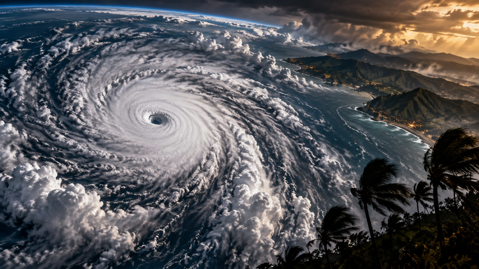
Hurricane Polo Undergoes Explosive Rapid Intensification
Hurricane Polo Has Exploded Into A 180 MPH Category 5
Hurricane Polo has undergone an extraordinary burst of intensification over the eastern Pacific, with aircraft measurements on Tuesday finding maximum sustained winds near 180 mph, placing the cyclone firmly inside Category 5 territory. The hurricane’s minimum central pressure was measured at approximately 892 millibars, another indication of its extreme intensity.
At the time of that aircraft update, Polo was almost stationary roughly 210 miles south of Zihuatanejo and about 360 miles south-southeast of Manzanillo, Mexico. That combination matters. An extremely powerful hurricane racing harmlessly away from land presents one kind of danger; an exceptionally intense system barely moving beside a vulnerable coastline creates a very different problem.
The National Hurricane Center had already classified Polo as an “extremely dangerous” Category 5 hurricane earlier Tuesday, when sustained winds were estimated at 165 mph. Just hours later, Hurricane Hunter measurements indicated another substantial increase to 180 mph.
The Speed Of Polo’s Intensification Is The Stunning Part
Polo’s maximum wind speed is dramatic, but the speed at which the hurricane reached this point may be the more extraordinary part of the story.
Late Monday, Polo had sustained winds around 90 mph. By early Tuesday it had strengthened to 130 mph, then 150 mph, crossed the Category 5 threshold at 160 mph and continued climbing. Forecasters described the intensification during the preceding 24 hours as remarkable, with the hurricane strengthening by around 90 knots during one measured period.
This is rapid intensification on an extreme scale. Hurricanes obtain their energy from warm ocean water, but strong intensification requires far more than heat alone. Atmospheric moisture, low disruptive wind shear, favourable upper-level conditions and the internal organisation of the cyclone all have to cooperate.
Polo appears to have found an environment where several of those ingredients aligned simultaneously. Satellite observations revealed a compact, clearly defined eye surrounded by intense convection, while powerful outflow developed around the hurricane. The result was a storm capable of converting favourable environmental conditions into extraordinary wind speeds in a remarkably short period.
That wider Pacific environment also makes Polo particularly relevant alongside the very strong El Niño now being forecast and its potential global consequences. El Niño does not mean every individual hurricane can simply be blamed on the climate pattern, but the extraordinary state of the Pacific is an important backdrop to the weather unfolding across the basin.
Mexico Does Not Need A Direct Category 5 Landfall To Face Serious Danger
There is one crucial distinction in the current forecast: Polo’s catastrophic inner core is expected to remain offshore.
That is enormously important. Category 5 winds reaching populated areas would create an entirely different level of disaster risk. But an offshore track does not make Polo harmless, especially while the hurricane is moving so slowly near southwestern Mexico.
Tropical storm warnings have already been issued along parts of Mexico’s Pacific coastline. Heavy rainfall associated with Polo has been forecast across coastal portions of Guerrero and Michoacán, with earlier forecasts indicating 4 to 8 inches of rain and isolated totals potentially reaching 12 inches through Thursday.
Those numbers matter because mountainous terrain can turn intense tropical rainfall into something far more dangerous than an exceptionally wet day. Water running rapidly down steep slopes can produce flash flooding, while saturated hillsides can become vulnerable to mudslides.
Powerful swells generated by Polo are also expected to affect the coastline, bringing potentially life-threatening surf and rip currents even where the eye never crosses land.
The lesson is simple: the centre line on a hurricane forecast map is not the boundary between danger and safety.
Polo’s Near-Stationary Movement Adds Another Layer Of Uncertainty
At the latest aircraft update, Polo was essentially stationary.
That might sound less threatening than a hurricane charging directly towards land, but slow-moving tropical systems can create their own problems. When a cyclone lingers close to the same area, dangerous seas, rainfall and outer-band weather can persist longer than they would with a faster-moving storm.
Forecasters expect Polo to begin moving generally west-northwestward over the next couple of days. Earlier guidance kept the hurricane’s core close to, but predominantly offshore from, southwestern Mexico.
There is also inherent uncertainty when steering currents become weak. Small changes in atmospheric pressure patterns can produce meaningful changes in track when a hurricane is barely moving.
That makes Polo a storm where attention should remain focused not merely on whether a forecast graphic shows the centre offshore, but on how close the eyewall approaches land, how long rain bands affect coastal regions and where the eventual west-northwest turn begins.
A 180 MPH Hurricane Is Close To The Upper Edge Of The Scale
Category 5 begins at sustained winds of 157 mph.
Polo is now substantially above that threshold.
The Saffir-Simpson Hurricane Wind Scale does not create additional official categories once a hurricane reaches Category 5. A 160 mph hurricane and a 180 mph hurricane therefore carry the same category number, even though the physical difference in wind intensity is substantial.
That can make the simple phrase “Category 5” conceal just how extreme an individual storm has become. Wind energy does not increase in a neat linear relationship with the headline wind-speed number, meaning additional increases at this level represent enormous atmospheric forces.
Polo is also relatively compact. Earlier official estimates suggested hurricane-force winds extended roughly 30 nautical miles from the centre while tropical-storm-force winds extended about 80 nautical miles.
That compact structure is one reason the exact track matters so much. A comparatively small shift can significantly change which areas experience the most violent portion of the hurricane.
The Pacific Has Produced Another Remarkable Extreme
Polo arrives during an unusual period for the Pacific atmosphere.
Taylor Tailored has already examined how El Niño could become one of the defining global weather stories of the coming months, with exceptionally warm Pacific conditions capable of influencing weather patterns far beyond the tropical ocean itself.
It would be premature to turn Polo into simplistic proof of any single climate trend. Individual hurricanes are produced by a complex combination of ocean temperatures, atmospheric circulation, moisture, wind shear and internal storm dynamics.
But Polo demonstrates with uncomfortable clarity what can happen when an organised tropical cyclone encounters an environment capable of supporting extraordinary strengthening.
Modern forecasting has become considerably better at identifying the environments in which severe storms can develop, while AI-powered forecasting systems are increasingly changing how rapidly atmospheric threats can be modelled. Yet rapid intensification remains one of the most difficult and consequential problems in hurricane forecasting because the difference between a dangerous storm and an exceptional one can emerge incredibly quickly.
The Next Movement Could Matter More Than The 180 MPH Headline
Polo’s 180 mph winds make for an extraordinary headline. For people along Mexico’s southwestern coast, however, the next question is more practical: where does the hurricane move from here?
Internal changes within powerful hurricanes can cause their wind speeds to fluctuate. Eyewall replacement cycles, changes in ocean conditions and increasing wind shear can all alter intensity even while a cyclone remains extremely dangerous. Earlier official guidance anticipated eventual gradual weakening but still kept Polo at major-hurricane strength for an extended period.
The greatest relief would come if the hurricane’s expected west-northwestward movement carries its strongest winds progressively away from Mexico.
Until that happens, Polo remains close enough for rain, waves and tropical-storm conditions to matter — and powerful enough that even a modest deviation from the expected track deserves attention.
A tropical storm became a hurricane. The hurricane became a major hurricane. Then Polo crossed into Category 5 and aircraft found winds approaching 180 mph.
That entire escalation happened with breathtaking speed.
And that may ultimately be what makes Hurricane Polo so significant: not simply that an enormous Category 5 hurricane exists off Mexico, but how quickly the atmosphere managed to build one.
