The Miami Behind Vice City’s Ocean Beach
Where Does Miami End And Rockstar’s Vice City Begin?
A strip of pastel hotels faces the ocean. Behind the bright façades sit service entrances, lanes and roads leading towards a port. Recognising Miami in Grand Theft Auto VI takes seconds. Working out what, precisely, Rockstar has borrowed takes rather longer. A recognisable architectural style, a neighbourhood with a fictional name and a building copied down to its windows are three quite different claims.
Ahead of the advertised 19 November 2026 release, Rockstar’s own location guide is the place to start. It identifies Vice City and five other regions of Leonida. The strongest comparisons with Florida are the relationship between Vice City and greater Miami, the chain of the Leonida Keys and the wetlands of Grassrivers. Other locations combine features from several places. The advertised setting is a fictional state, and the pictures released so far cannot establish an exact correspondence for every street.
Ocean Beach And The Miami Beach Everybody Recognises
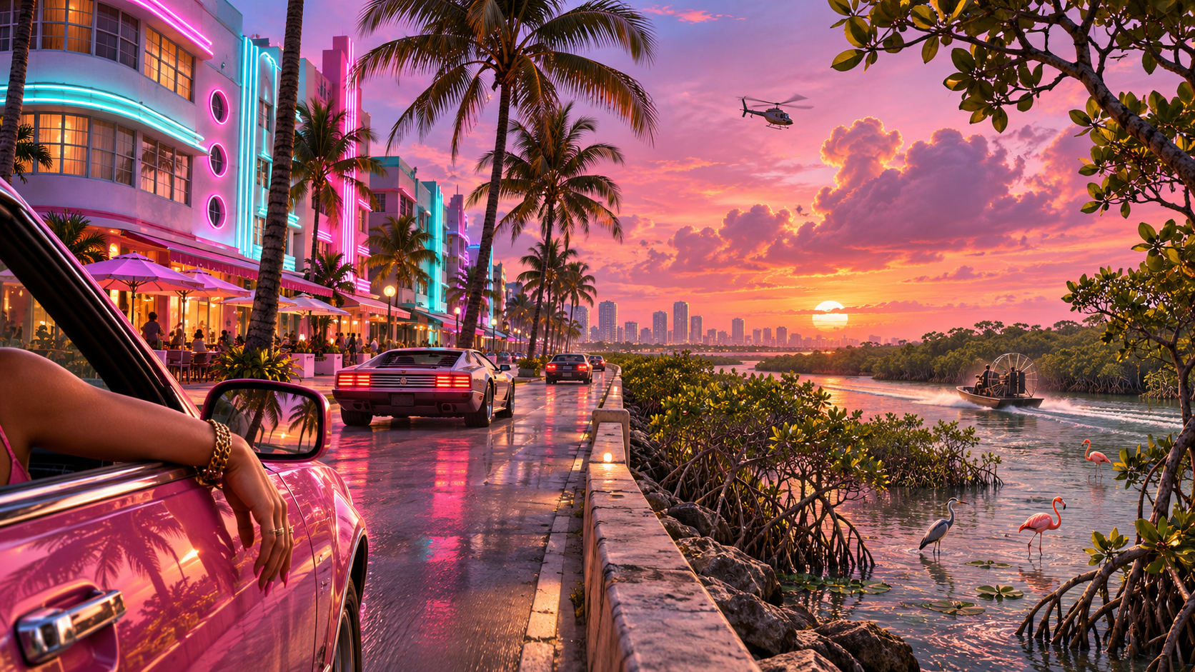
Rockstar identifies Ocean Beach as part of Vice City. Its low-rise hotels, curved corners, horizontal lines and brightly coloured façades evoke the Art Deco district of Miami Beach. Those are details a visitor can compare without knowing the name of a single fictional hotel. Taken together they express a particular time in the development of a resort city, when even the building containing a modest bedroom could sell the prospect of a glamorous holiday.
The distinction between Miami and Miami Beach helps explain the setting. Real Miami Beach occupies barrier islands across the bay from mainland Miami. A person can travel from a beachfront hotel to a downtown office and pass through quite different urban environments. A fictional city compressing those journeys can preserve the experience of crossing water and entering another world while doing considerable violence to a real road map.
It is tempting to take two screenshots with matching balconies and pronounce a hotel identified. Similar cornices and porthole-like windows recur across dozens of buildings. A confident identification needs several independent details in the right relationship. An unusual corner, the configuration of the frontage and the position of a neighbouring block offer more than a shared coat of pink paint.
Little Cuba And The City Behind The Holiday Postcard
Little Cuba invites a comparison with Little Havana. The significance goes beyond a Spanish name on a shop. Miami’s Cuban communities have helped shape the city’s political life, food, language, businesses and neighbourhood institutions. A games writer looking for the identity of Vice City in a beach montage alone would miss one of the clearest clues in the place names.
Rockstar also identifies a port. Ports can look rather anonymous from the air: containers in rectangles, sheds by deep water and roads wide enough to turn a lorry. Their economic role changes the way to understand the map. A waterfront used by visitors lies alongside another waterfront through which goods and workers move. A postcard sells access to one sort of shore. A working city needs both.
For readers familiar with the earlier Vice City, an updated setting complicates the comparison again. A fictional location can refer simultaneously to contemporary Florida and to a place players remember from another game. Recognising a name from the franchise is evidence of continuity in Rockstar’s world. It is not independent proof that the street has the same layout or occupies the same real-world coordinates.
The Leonida Keys And The Logic Of An Island Road
The real Florida Keys stretch away from the southern end of the peninsula. Roads and bridges bind separate islands into a journey. That arrangement makes the Keys a particularly rich source for a game map. In a gridded downtown, a driver who misses a turn can often recover at the next junction. Out on an island chain, a broken or blocked crossing can change the whole route.
Rockstar explicitly names the Leonida Keys. The real comparison is strong at the regional scale. Open water, low land, marinas and the experience of driving across long stretches of exposed bridge are more informative clues than an attempt to match every island to one of the real Keys. Altering the number, size or spacing of the fictional islands could improve play while leaving the identity of the landscape immediately recognisable.
There is an everyday economic story here too. A waterfront that looks idyllic to visitors may support people repairing engines, taking out boats, unloading supplies or working seasonal jobs. The contrast gives the fictional Keys a different kind of richness from a collection of tropical backdrops.
Grassrivers And Florida’s Everglades
The name Grassrivers makes sense once you stop imagining a river as a narrow channel with obvious banks. In the Everglades, water moves across a broad, shallow landscape of wetlands and sawgrass. Slight changes in elevation can change what grows, where water collects and which routes are practicable. A patch that appears to be firm green ground from the air can be a difficult place to cross.
That makes Grassrivers a convincing regional parallel without making every wetland detail a copy of a national park. Mangroves, inland marshes and wooded patches can be brought closer together than their real equivalents. The comparison works because the nature of the journey changes. Seeing a destination across open grass tells you little about whether you can drive there.
What The Overseas Highway Adds To The Comparison
The real route through the Florida Keys carries an earlier feat of engineering inside it. Before motorists drove the island chain, an overseas railway connected the islands to Key West. After the destructive 1935 hurricane, parts of the railway infrastructure became the basis for a road. A bridge in the Keys can therefore belong to two histories at once, one written by railway engineers and another by people who remade a damaged route for motor traffic.
For a game designer the attraction is readily apparent. Repetition creates rhythm: island, water, bridge, island. Small changes in the width of the road or the condition of a structure suddenly take on significance because the open water offers no easy detour. A single long span can make a journey memorable without requiring a tall skyline or a succession of named landmarks. This is a case where the geography, rather than any individual building, is the strongest source of resemblance.
It is also a case where history prevents an easy mistake. An older structure beside a modern road need not be an abandoned version of the same highway. It could come from a railway, an earlier road alignment or access infrastructure. Where a Rockstar screenshot shows an adjacent structure, the image may evoke that layered history. Its appearance alone cannot tell players what the developers intend it to be or whether it will be accessible.
How To Tell A Real Landmark From A Good Guess
Start by identifying the source image. Official artwork, an in-game screenshot, a promotional trailer and a picture assembled by fans have different evidential value. Artwork can exaggerate scale or place several ideas within the same frame. A trailer can cut from one locality to another between shots. Two locations shown consecutively are not necessarily connected by the road that appears between them.
Next identify what is distinctive. Palm trees, bright paint and neon signage occur in many coastal cities. An unusual roofline, the alignment of a causeway with an inlet and the position of a tower can jointly make a much stronger identification. If the claimed match depends on quietly reversing the image or overlooking a major body of water, the conclusion needs a qualifier.
Finally ask which part of the claim matters. “This evokes South Beach” can be right even if no hotel in the fictional block corresponds exactly to a real one. “This is the same hotel, and its back entrance will lead to a particular mission” makes two additional claims, each requiring independent evidence. The distinction is particularly important before players can travel the finished map and test their assumptions.
Visitors comparing real Florida with Leonida will also encounter a practical issue. Two photographs taken at different times of day can make an identical building seem unfamiliar; a warm colour grade can make unrelated buildings seem close cousins. Structure and geography generally offer stronger evidence than the colour of a sunset. The pleasure of spotting an influence is considerably greater when the identification survives daylight.
Why Distance Is The Thing Rockstar Is Most Likely To Change
A real journey between a coastal city, farmland and a remote wetland can involve long periods in which very little changes. A game world has to keep giving the player decisions. Reducing a real journey from hours to minutes can preserve the order in which different landscapes reveal themselves while removing much of the space between them.
This means that even a perfectly recognised stretch of street offers weak evidence about what ought to lie a mile further on. A designer may bring a port nearer to a beach to give players a new route, place an inland community beside a road that would bypass it in reality or give a flat landscape extra elevation so a driver can see what is coming. Such changes can make the visual language of the region easier to read from a moving vehicle.
The real-world comparison works best when it explains a choice like that. Identifying an influence is enjoyable. Understanding why an imaginary state needs a city of visitors, a port of workers, a chain of islands and an expanse of difficult wet ground explains why those influences belong on the same map.
The Geography Of A Trailer Cut
Try the following exercise with a sequence of promotional images. List what each frame establishes on its own. A boat is shown on dark water. A later frame shows a bridge in daylight. A third shows a character beside a vehicle at a marina. It may feel as though you have just travelled from the boat to the bridge to the marina. Unless the connecting journey is visible, the editing has created that route in your head.
Film trailers do this all the time, and for good reasons. Their job is to introduce a world and establish pace. They can put a bustling street beside a quiet inlet to show variety, or pair two images because their colours make a satisfying cut. A fan trying to reconstruct road distances from the edit is asking the material to perform a surveying job for which it was never designed.
The same caution improves comparisons with Miami photographs. A long lens can make a city skyline look as if it stands immediately behind a bridge. A wide-angle view can make a narrow beach appear enormous. A diagram based on where the buildings stand may be more reliable than a strikingly similar skyline compressed by an unfamiliar focal length. Perspective is part of the evidence.
How To Read Leonida As More Than A List Of Destinations
One way to make sense of the six regions is to ask what flows between them. The port handles goods; the beaches attract visitors; the agricultural region grows and processes a commodity; the Keys connect islands; the wetlands interrupt easy passage across land. Those functions generate very different roads and buildings. Even before an official map settles their precise arrangement, the relationships make sense.
A second question is who uses each landscape after the visitors have gone. A worker closing up an Ocean Beach hotel belongs to a different economic geography from a tourist ordering a drink on its terrace. A person who maintains boats may see the same marina primarily as a workplace. Familiar Florida imagery often concentrates on what a visitor can see from a car window. Rockstar’s juxtaposition of freight, sugar, motels and expensive beachfront property gives the setting a chance to show who keeps the postcard functioning.
That is a richer comparison than declaring Vice City “basically Miami”. Greater Miami itself contains places a visitor on a short holiday will never see. Leonida can exaggerate or compress them and still make an observant player curious about what lies beyond the seafront in the real place.
The comparison also works in the opposite direction. Someone who first encounters a wetland or an island road in the game may later recognise the relationship in real Florida. The useful question on arriving is which elements the game left out. A protected habitat has rules about access. A working port has security boundaries. A residential street contains people with a stake in who comes to photograph it. Fiction can make the geography legible while omitting most of the responsibilities of actually visiting.
Port Gellhorn, Ambrosia And Mount Kalaga
Rockstar’s Port Gellhorn presents another side of coastal development. Roadside businesses, cheaper accommodation and the infrastructure of an older resort economy give it a texture distinct from Ocean Beach. Several Florida communities share that history. Precise claims that the whole place represents a particular city need more evidence than a water tower or a weathered motel sign.
Ambrosia has an industrial identity, including sugar production. That points towards the agricultural and processing landscapes of inland and southern Florida. Sugar is especially interesting because it connects the town to things a skyline fails to show: water management, freight, farmland and seasonal work. A sugar plant can be a stronger regional clue than an invented town name.
Mount Kalaga National Park shows why a literal overlay breaks down. Florida is famously low-lying. Rockstar can draw on southern woodland, rural recreation and outdoor culture while introducing relief or scenery better suited to a fictional state. The official name establishes that Mount Kalaga exists in Leonida. It does not identify a Florida mountain that players ought to be able to find on a road atlas.
The most revealing pre-release map is therefore a map of comparisons with different levels of confidence. Vice City and Miami, the Keys and the Keys, Grassrivers and the Everglades are strong regional connections. A specific street or business demands stronger evidence. The imaginative achievement is that a few minutes travelling from hotel frontage to mangrove water can feel unmistakably like Florida even where no such journey exists.
