What 48 AI Agents Actually Found in Mexico
Can A Computer Find A Maya Settlement That Archaeologists Have Already Mapped?
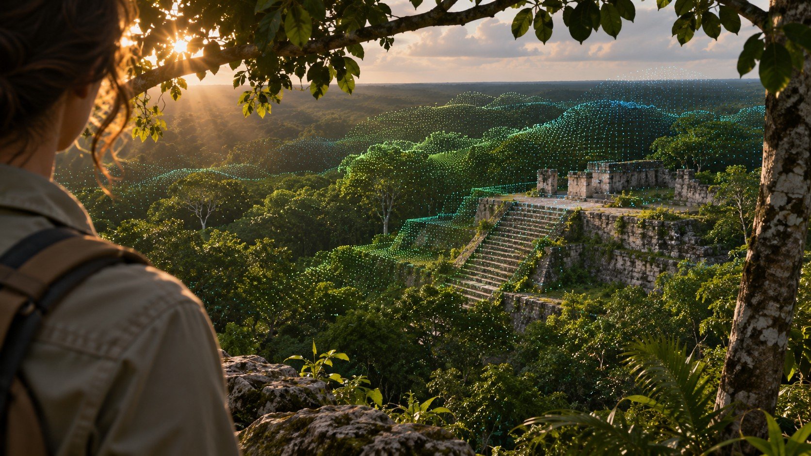
The most interesting thing about the supposed AI discovery in Mexico is that there really was something there. In November 2026, software agents working for researcher Pietro Miotti picked out what looked like traces of a Maya settlement. The feature survived the first test of a promising archaeological lead. The more difficult claim, that the location was unknown, ran into a paper published the previous year. An archaeologist who had helped document it recognised what the agents had found.
Those two results can sit comfortably together. A system can detect something real and be wrong about its novelty. If you want to understand what artificial intelligence might contribute to archaeology, it is worth following the gap between those achievements. The hardest information to extract from a map is often who has looked at the same piece of ground before.
How A Personal Project Became A Discovery Claim
Miotti described the experiment as a personal undertaking. He worked at Google, but told reporters that he had used neither company computing resources nor company backing for the project. His interest began during a visit to Peru. The availability of public laser mapping data helped steer him towards the Maya region instead. That choice matters. The search area reflected where information happened to be available as well as where past societies had lived.
He used a group of 48 AI agents to examine data and investigate promising features. An agent in this context is software that can pursue intermediate steps towards a task, such as inspecting a map, comparing patterns or searching records. Forty-eight agents are not the equivalent of 48 independent archaeological witnesses. If they rely on similar models, common data and the same limited sources, agreement can tell you a great deal about how reproducible a procedure is and very little about what all of them missed.
One cluster appeared particularly promising. Miotti contacted Mexico’s National Institute of Anthropology and History, known as INAH. According to his account, an inquiry assisted by machine translation produced a reply indicating that the location was not registered in the record checked. He acknowledged the need for professional investigation. The story travelled rapidly because the combination of a recognisable structure, a government reply and a very short turnaround made an unusually persuasive sequence.
Then came a check of a different kind. Reporting on the claim identified a 2025 academic publication documenting the site and obtained comment from co-author Ivan Šprajc. A database response had answered a narrower question than the one the public story seemed to settle. Whether the particular coordinates returned an entry in a register and whether archaeologists had surveyed and published the place were separate enquiries with different answers.
What Lidar Actually Sees Below The Trees
Airborne lidar sends pulses of laser light towards the ground and measures how long reflected light takes to return. Over woodland, some returns come from leaves and branches. Others come through gaps in the canopy from surfaces nearer the ground. Taken together, the measurements produce a cloud of points with positions and elevations. Processing can select likely ground returns and estimate the shape of the terrain beneath much of the vegetation.
Calling this process a way of seeing through trees is convenient and a little deceptive. The laser needs a path. Dense foliage can leave very few ground measurements in a particular patch. A continuous-looking terrain image may include areas reconstructed between sparse points. Before making an archaeological inference, a researcher wants to know how well the specific feature was sampled, how the ground was classified and what processing produced the apparent edges.
On a shaded terrain model, a low rectangular platform may be much easier to spot than it would be on foot in dense forest. Change the direction of the simulated lighting and a faint ridge can become obvious or almost disappear. Features that continue across neighbouring strips of data are more persuasive than a shape present only along a processing boundary. Looking at the underlying elevations can help determine whether a convincing shadow corresponds to a measurable rise.
A regular structure can still be recent. Roads, agricultural terraces, drainage works and the scars of modern activity can form straight lines or tidy rectangles. Natural topography can look surprisingly deliberate at one scale. Context strengthens an interpretation: the relationship between a platform and nearby surfaces, the orientation of repeated features and comparisons with excavated examples. A machine that spots rectilinear shapes is doing useful work. Assigning those shapes to a particular people and period requires additional evidence.
The Word Unknown Needs An Audience
Unknown to whom? A visiting researcher may encounter a feature for the first time that residents have known since childhood. Residents may know the ground extremely well without using the terminology of an archaeological inventory. A community name may differ from a project name, a historical spelling or a label used by an international journal. Neither a new English-language description nor a missing search result can establish that nobody had encountered the place.
Even within professional archaeology, a site can exist in several records that describe different things. A survey might give a name to a broad settlement zone. A paper might plot a cluster of buildings within it. An administrative register may store a point representing the centre of the larger site. A search around the coordinates of an outlying platform might miss that point although the surveyed area encompasses the platform perfectly well.
This is one reason that maps in printed or scanned papers remain important. A feature may appear graphically without a machine-readable coordinate in the text. A supplementary file can carry identifiers absent from the abstract. Unpublished field reports, earlier work in another language and collections held locally may answer questions that a general internet search barely begins to address. The boundary of what is searchable is also shaped by decisions about who should have access to sensitive information.
Consider how an expert could recognise a settlement when a software search misses its name. Its plan, relative position on a ridge and proximity to a neighbouring complex might together be as distinctive as a street corner is to a resident. Recognition can then lead back to the relevant publication. The expert’s contribution is more specific than a general appeal to authority. It supplies an earlier, dated account that somebody else can inspect and compare.
How To Test An AI Lead Fairly
The first question is whether another investigator can reproduce the observation. Retain the original data source, the processing choices, the resolution and the area examined. A selected screenshot can show what caught the investigator’s eye. It cannot show whether the feature persists under alternative processing or how many similar-looking candidates were inspected and discarded. A credible search reports enough about its sampling to make a lucky success interpretable.
Next compare the shape with control locations. If a procedure identifies dozens of obvious modern earthworks as ancient platforms, the time required to investigate its false alarms becomes part of its practical cost. Conversely, testing it against known sites can reveal which forms it consistently misses. This is where rediscovery can have real scientific value. A documented location can act as a benchmark, provided the evaluation accounts for whether descriptions of it were already present in the material the system could access.
A novelty check then has to follow the regional literature and the institutions that hold survey records. It should describe the limits of the search in terms somebody else can assess. There is a meaningful difference between saying an investigator found no matching entry in a named catalogue and announcing a previously unknown ancient settlement. The first is a reproducible statement about an enquiry. The second makes a historical claim about a much larger body of knowledge.
Where appropriate, authorised fieldworkers and local partners can investigate what is actually on the ground. A walkover may reveal features hidden by the visualisation or show that an apparent wall has a recent origin. Dating usually calls for other evidence, potentially including associated material or documented excavation contexts. Walking into a place with a plausible map does not itself grant permission to enter, dig or make its location public. Publication choices affect the people and heritage left there long after a viral post disappears.
Where Machines Could Earn Their Place
A better question than whether AI can replace an archaeologist is whether it can make a particular stage of a survey faster or more consistent. Researchers might ask a tool to rank candidate platforms across a defined area, then compare its choices with independent expert assessments. The outcome could be measured in missed sites, false positives and hours saved. A result showing that software works well in open ground and poorly under dense canopy would be valuable even if no spectacular monument emerged.
There is another useful comparison with medical screening. A sensitive search can be designed to flag nearly every possible anomaly, on the understanding that a person will reject many of them later. That can be a sensible choice if checking a flagged image is cheap and missing a rare feature is costly. The threshold should be quite different if each flag triggers an expensive expedition. A publicity announcement effectively skips from the first threshold to the last, often without the additional checks that would justify the change.
The way evidence is released can make a correction easier or harder. A general outline of the terrain, the processing method and an independently checked comparison with the published plan can establish how an identification was made while withholding precise coordinates. Readers can assess whether the two survey descriptions concern the same place. Protecting a vulnerable site need not require withholding the reasoning behind the conclusion. It may instead require working with the responsible heritage authority on which details belong in public.
In this case, the most economical independent check involved reading. The expensive step would have been sending people into the forest to establish something archaeologists could already show from their records. Knowing where earlier teams worked makes that search both quicker and more accountable to local expertise.
There is also scope for less glamorous work on the records themselves. Matching variant spellings, flagging overlapping map boundaries and retrieving figures from older surveys could spare researchers days of duplicated effort. Such tasks require care over permissions and interpretation, but they address the very bottleneck this episode exposed. Better connections between a map and existing knowledge could matter as much as a sharper detector of geometric shapes.
The November claim leaves a neat reversal. Earlier archaeological work allowed the public to recognise that the agents had picked out a real site. That same work established that the site was already documented. The positive result and the correction came from the same source of expertise. An honest description would give the software credit for detection and the earlier investigators credit for the discovery. Then researchers could get on with the more interesting experiment: finding out what this method can reliably add to the map.
Sources
My AI Agents Found an Unmapped Maya Site — The researcher’s own account of the search.
New regional-scale Classic Maya population density estimates and settlement distribution models through airborne lidar scanning — Published regional lidar work relevant to the identification.
No, AI agents did not discover a previously unknown Maya site — The correction and the response from a co-author of the earlier paper.
Next Reads
What Makes A Civilisation? The Evidence Behind The Label — How archaeologists decide what material remains can establish.
Ancient Treasures Found After Ukraine Dam Destruction — What changing landscapes bring to light.
Which Parts of the Bible Has Archaeology Confirmed? — How archaeological finds are tested against existing historical records.
