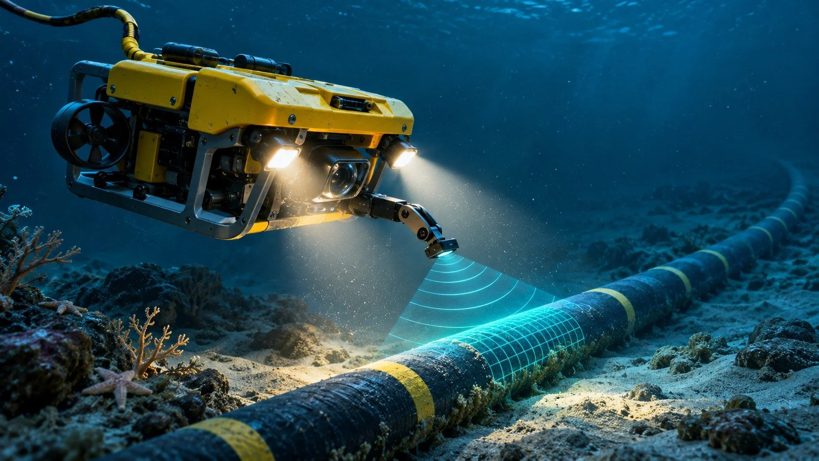
Understand how underwater drones find damaged cables in the context of ROV.
How Do You Find a Break in a Cable You Cannot See From the Ship?
The first instrument used to find a damaged submarine internet cable may be on land, hundreds of kilometres from the fault. A terminal can lose a signal, record a change in optical performance or detect an electrical problem with the equipment powered along the route. Engineers use that evidence to narrow the search before a vessel commits time and equipment to a patch of seabed. The underwater robot often enters the story after much of the detective work has already happened.
Britain’s announcement of investment in drones and sensors to counter undersea threats has brought those machines into the news. Military monitoring and commercial cable repair overlap in their need to observe a difficult environment. Their purposes differ. A repair team can succeed by finding and restoring a damaged connection without ever determining who or what damaged it. An investigation into responsibility has a further question to answer.
What Does the Landing Station Know?
A submarine telecommunications system is more than a long piece of glass. Fibre carries information as light. Long ocean crossings typically use submerged optical amplifiers, often called repeaters, powered through a conductor in the cable. Shore stations monitor the behaviour of the system. A loss of communications can arise in terminal equipment, an individual fibre path, the powered equipment or the physical cable itself.
The first task is therefore to characterise the fault. Are all relevant paths affected? Are signals arriving from one direction? Which parts of the supervisory system still respond? A clean loss across many paths at the same instant suggests a different line of inquiry from one channel gradually degrading. Engineers compare readings from the two ends where possible and check whether a problem at a station could explain the symptoms.
Operators can also work to reroute traffic while this is happening. A user whose connection still works may assume the submarine cable has repaired itself. Their data may simply be taking a different route. Restoring service to customers and restoring the damaged physical asset are separate jobs with different timescales.
Can a Pulse of Light Measure the Distance?
On suitable fibre sections an optical time-domain reflectometer sends a pulse and measures faint light returned along the path. Some light scatters back throughout the fibre. Certain changes or breaks can produce a distinctive event in the trace. The instrument measures elapsed time, and an estimate of the speed of light in the glass converts it to distance. The pulse travels out and the return comes back, so the round trip must be allowed for.
That is the principle. Its application depends on the system. On a long repeatered ocean cable a basic shore instrument cannot necessarily look straight through every amplifier and see the far side of an ocean. Supervisory arrangements may first localise trouble to a section between particular pieces of equipment. Different designs support different tests. Electrical measurements can contribute information when the power conductor is affected.
Even a good fibre-distance estimate is not a latitude and longitude. The glass follows the cable structure. The cable follows a surveyed route across uneven ground, with slack allowed during laying and possible changes from earlier repairs. Distance measured along the system must be related to the installed route and the installation records. Drawing a circle of the same radius around the landing station would give the ship a great deal of ocean to search.
What Does the Crew Take to Sea?
The ship needs the cable route, records of previous work, information about local depths and hazards, a search area derived from tests, and equipment suited to the likely recovery. A fault on a buried cable near a busy coast presents different conditions from a fault on an exposed deep-ocean segment. Weather, currents, permissions, vessel availability and the location of suitable spare cable can all influence the timetable.
A route map also allows the crew to approach the target from a stretch where the cable is expected to be intact. Following a known line towards an anomaly can be more informative than searching an isolated coordinate for a severed end. A dragged cable may have moved from its original position. A buried one may leave no visible line at all.
There is a useful distinction between search width and identification. A sensor sweeping a broad strip can flag an object or a disturbed area. Identifying the particular cable, distinguishing it from others nearby and deciding whether it is safe to engage may require a slower pass with a different instrument. Searching quickly and acting confidently are rarely the same operation.
What Can an Underwater Robot See?
A remotely operated vehicle, or ROV, is linked to the surface through a tether. Pilots can manoeuvre it near the seabed, receive images and sensor readings, and operate tools where the vehicle and task permit. An autonomous underwater vehicle can follow a survey plan without that continuous physical connection. The everyday word “drone” covers machines with quite different capacities for intervention.
Sonar uses sound to reveal features beyond the short range of underwater lighting. Side-scan sonar can show contrasts and shadows associated with an exposed object or changes in the bottom. A camera gives a more immediately recognisable view when the vehicle gets close enough and the water is clear. Lights can become a liability in disturbed sediment, illuminating suspended particles directly in front of the lens.
Some vehicles carry cable-tracking equipment suited to detecting or tracing a line that a camera cannot see. Whether a buried cable can be tracked depends on its construction, burial depth, available signal and the equipment in use. There is no universal screen on which every buried line lights up with its owner’s name and the point of damage neatly marked.
Navigation adds another challenge. Satellite positioning works for the surface vessel. It does not reach a submerged vehicle in the same way. Acoustic positioning, estimates of the vehicle’s motion and other navigation instruments help relate the vehicle’s location to the ship and the chart. A beautiful photograph of a damaged cable has much greater operational value if the crew can return to precisely the same place.
Does Every Repair Need a Drone?
No. Cable ships have long recovered damaged cables with specialised grapnels. The choice depends on depth, seabed conditions, nearby infrastructure, burial and what the repair requires. An ROV can be particularly valuable when the team needs to examine the site closely, uncover a section or work selectively around other assets. Its usefulness does not make it compulsory on every job.
Where circumstances permit, a damaged section is recovered to the surface for jointing. The crew tests the ends, removes compromised material and joins a replacement length. Fibres require exact alignment. Mechanical strength, electrical continuity where relevant, insulation and protection against the marine environment must also be restored. A joint that carries light at the ship’s workbench still has to survive deployment and years at sea.
The repaired section is laid back with enough slack for the operation. It may be reburied where the design and local conditions call for protection. Tests confirm that the system is working, and the route record is updated. That last, less photogenic task is a gift to the next crew. A repair that changes the cable’s length or its position has also changed the evidence future engineers will use to find it.
Why Can a Cable Be Harder to Find in Shallow Water?
Being close to shore shortens the voyage and permits different kinds of equipment. It also places the cable in an environment shaped by tides, mobile sediment, fishing and shipping. The original route may pass through a crowded corridor. A section deliberately buried for protection is precisely the section a visual survey will struggle to follow. A ship held close to a reported position can still be a poor platform from which to see beneath a moving layer of sand.
An exposed cable in deep water presents the opposite mixture of difficulties. There may be fewer nearby assets and less sediment hiding the line, but a vehicle must withstand high pressure and travel a long vertical distance before doing any useful work. A long tether adds drag and complicates handling. Recovering a cable over great depth brings mechanical demands that have little to do with the apparent simplicity of the damage.
That is why a ready-made answer such as “send a camera down” leaves out the most expensive part of the decision. The operator needs equipment capable of reaching the depth, collecting the right evidence and returning it in a form the repair team can use. Sending the wrong vehicle quickly can cost more time than spending another hour interpreting the shore measurements.
What if the Cable Has Been Dragged Sideways?
A lateral displacement can break the assumed relationship between the chart and the actual cable. The search may need to establish the line on either side of a disturbed area and follow it towards the fault. Marks in sediment, changes in cable orientation and the position of a severed end can be documented together. Finding two separated ends may be a distinct problem from detecting the first sign of damage.
A repair may also add a loop because the ends must be brought aboard a vessel and enough cable supplied to make the new connections. That extra length has implications for the next fault-location estimate. An accurately updated cable record keeps today’s repair from turning into tomorrow’s mystery. A familiar-looking piece of engineering paperwork can be as important to the next successful survey as the vehicle that made the last one possible.
The timetable also depends on access. Local maritime traffic, permissions and safe working conditions can constrain the ship even after the fault is well located. A long repair does not necessarily mean the operator spent that whole time searching.
Can the Damage Reveal Whether It Was Sabotage?
A survey can document where a cable moved, whether its protective layers were disturbed and what marks appear nearby. Investigators may compare that evidence with vessel movements, weather, seabed activity and the timing of faults. Images are one part of a larger inquiry. A mark consistent with an anchor does not, by itself, explain why the anchor was down or what the people on the vessel intended.
That is the real achievement behind a photograph from the bottom of the sea. A failure detected on land has been translated into a distance, a section of route, a survey and finally a piece of physical evidence. A robot can bring a human observer extraordinarily close to the break. Understanding what the picture means still depends on all the work that brought the camera there.
Sources
ITU-T G.971 — General Features of Optical Fibre Submarine Cable Systems — The ITU technical standard describes fault localisation in submarine systems.
£90 million investment for new drones and sensors to protect undersea cables and hunt Russian submarines — The Royal Navy explains the UK commitment to underwater sensors and drones.
Resilience of submarine data cable infrastructure in Europe – Mapping, risk assessments, stress tests - Annex — European technical background on submarine cable infrastructure and resilience.
Next Reads
What Happens When An Undersea Internet Cable Breaks? — Follow what happens to traffic when a link fails.
Why Would Britain Run an Internet Cable From Shetland to Norway? — Understand a proposed North Sea communications route.
What If a Major North Atlantic Undersea Cable Was Cut — Explore the consequences of losing a major connection.
