Nepal Flash Flood Sweeps Away Homes And Bridges As Four Go Missing And Mass Evacuations Begin
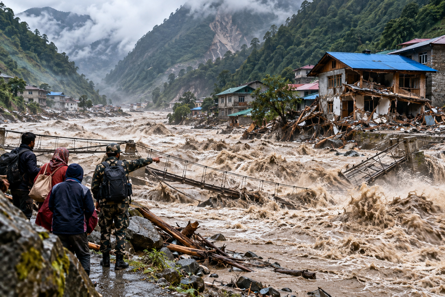
Nepal On High Alert As Sudden Flash Flood Tears Through Gorkha And Threatens Communities Downstream
The Himalayan Flood Emergency
A suspected landslide dam failure sent floodwaters surging through the Budhi Gandaki River on 11 October 2026, destroying infrastructure and triggering evacuations just weeks after Nepal's catastrophic August floods.
Nepal's River Flood Disaster Leaves Four People Missing
Nepal has launched emergency evacuations after a sudden flash flood swept through mountain communities, destroyed homes and bridges, and left four people reported missing in the country's Gorkha district.
The disaster struck early on Sunday, 11 October 2026, when water surged through the Budhi Gandaki River, approximately 100 kilometres west of the capital, Kathmandu.
Authorities believe a landslide blocked a mountain waterway, creating a temporary natural dam. Water may then have accumulated behind the obstruction before breaking through and rushing downstream.
Homes and livestock shelters were swept away. Suspension bridges disappeared into the swollen river, while damage to a hydroelectric project raised concerns about the vulnerability of critical infrastructure.
Four residents were reported unaccounted for near the Ungilung River in Chumchet. Initial official accounts had recorded no confirmed casualties, and the missing-person reports did not establish that anyone had died.
Nepal's National Disaster Risk Reduction and Management Authority urged communities along the river to reach safer ground as soldiers, police officers and emergency personnel mobilised.
The flood has struck a country still struggling to recover from one of its deadliest natural disasters in recent history.
Four Missing As Homes And Bridges Are Swept Away
The first signs of destruction emerged from the mountainous Chumnubri area, where small settlements lie close to fast-flowing rivers.
Local accounts described a violent rise in water levels before the river overwhelmed buildings near its banks.
Four people staying in a livestock shelter beside the Ungilung River were reported missing after the flooding. Villagers searching the area said the shelter itself could no longer be found.
The flood also swept away livestock shelters and approximately 15 yaks and female yaks, according to information attributed to Nepal's national news agency.
Elsewhere in Gorkha, officials described extensive damage to buildings, roads and river crossings.
District administrator Dharmendra Kumar Mishra said several houses and two suspension bridges had been destroyed. Other assessments indicated that roughly a dozen houses had been swept away.
A highway bridge connecting Gorkha with neighbouring Dhading district was also reported destroyed, threatening transport between communities already difficult to reach.
The destruction presents an immediate logistical problem. Bridges in these valleys are not merely convenient crossings. They connect villages with markets, medical facilities, schools and emergency services.
When they disappear, communities can become isolated even after the floodwater retreats.
How A Landslide May Have Unleashed The Flood
The emerging explanation centres on a natural dam formed when rock and earth fell into a mountain waterway.
Nepal's flood forecasting authorities indicated that the sudden surge may have followed a landslide near Tumje in Chumnubri Rural Municipality.
Preliminary analysis suggested that rainfall alone was unlikely to explain the event. Available observations indicated only scattered rainfall in the preceding 24 hours.
Satellite imagery and early field information instead pointed towards a possible landslide blockage.
A landslide can obstruct a narrow river valley, trapping water behind rock, mud and debris. As pressure increases, the blockage may become unstable.
When that barrier fails, accumulated water can escape suddenly.
Unlike ordinary flooding caused by prolonged rainfall, this process can release a destructive surge with little warning to people living downstream.
Such floods may carry substantial quantities of sediment, boulders and fallen trees, increasing their ability to damage structures and riverbanks.
The same mechanism was among those investigated after Nepal's catastrophic glacier collapse in August.
The exact sequence behind Sunday's flood remains under technical investigation. A suspected landslide dam failure is not yet a final scientific finding.
River Levels Surge Beyond The Danger Threshold
Monitoring data revealed how rapidly conditions deteriorated downstream.
According to figures released by Nepal's flood forecasting authorities, the Budhi Gandaki River at the Aarughat monitoring station stood at approximately 2.28 metres at 6:30 a.m. local time.
It subsequently climbed to 3.66 metres before crossing the five-metre danger threshold.
By 7:50 a.m., the water level had reached 5.01 metres.
After briefly falling, it rose sharply again, reaching approximately 6.22 metres at 8:30 a.m. and 8.43 metres ten minutes later.
That rapid increase demonstrates why emergency warnings were extended beyond the communities initially affected.
A river can become dangerous many kilometres away from the original landslide, especially when its channel carries a sudden pulse of accumulated water.
Authorities issued warnings through mobile phone messages, loudspeakers and public announcements.
Residents were told to move away from vulnerable riverbanks rather than wait for water to reach their homes.
Emergency Evacuations Spread Across Multiple Districts
Nepal's disaster management authority extended alerts across several downstream districts, including Gorkha, Tanahun, Chitwan, East Nawalparasi and West Nawalparasi.
The Budhi Gandaki flows into the wider Trishuli River system, meaning the consequences of an upstream surge can extend far beyond the original mountain settlement.
Evacuations also affected Arughat, an important riverside town connected to the country's road network.
Local authorities urged people living near waterways to move to higher ground and remain alert for changing river conditions.
The Nepalese Army rescued six people threatened by a landslide in Jagat, according to Prime Minister Balendra Shah.
Another 18 workers at a damaged hydroelectric project camp escaped to safety.
Army and police personnel were deployed to affected communities, while helicopters supported aerial monitoring and emergency operations.
The rescue effort faces difficulties familiar to Nepal's mountain districts: steep terrain, limited access routes and river crossings vulnerable to sudden destruction.
Officials must also establish whether further landslides, unstable debris or renewed water surges could endanger rescuers and residents.
The number of people requiring assistance may change as authorities reach more isolated settlements.
Nepal Is Still Recovering From August's Catastrophic Floods
The latest emergency comes less than seven weeks after devastating flooding struck Nepal's mountainous border region with Tibet on 26 August 2026.
That disaster killed more than 1,400 people and left thousands missing.
By early October, Nepalese authorities had formally ended the main search-and-rescue operation, shifting attention towards recovery and reconstruction.
Around 33,000 people were affected, while approximately 7,500 homes were damaged or destroyed.
The government estimated that rebuilding would cost approximately 4.77 billion US dollars.
Roads, bridges, settlements and hydroelectric facilities suffered extensive damage, leaving major challenges for communities attempting to resume ordinary life.
Some of the most difficult recovery operations involved workers trapped or missing around hydropower infrastructure. In one extraordinary rescue, two workers were found alive in a Nepalese tunnel nine days after the August floods.
The October disaster is a separate flood in a different part of the river system. Its immediate human toll is not comparable with the August catastrophe.
Nevertheless, the two events expose a similar vulnerability.
Mountain communities can be struck by destructive flooding originating far upstream, sometimes before local rainfall or river conditions give residents an obvious reason to expect danger.
Why Himalayan Rivers Can Become So Dangerous
Nepal's geography makes sudden floods particularly destructive.
Many rivers begin high in the Himalayas before descending through narrow valleys towards densely populated lower regions.
Their channels can carry enormous volumes of water and sediment, particularly when natural barriers collapse or unstable slopes fail.
Steep valley walls concentrate the flow. Buildings, roads and bridges positioned near rivers can therefore face substantial forces during a sudden surge.
Hydroelectric projects are especially exposed because they depend on access to fast-flowing river systems.
The same waterways that provide electricity and support economic development can become sources of considerable danger when their flow changes abruptly.
Scientists studying the Himalayas have also raised concerns about changing glacier conditions, thawing mountain environments and unstable slopes.
However, it would be premature to attribute Sunday's individual landslide or flood directly to climate change.
The immediate physical trigger is still being investigated, and establishing a broader climatic contribution would require additional evidence.
What is already clear is that Nepal needs reliable monitoring and warning systems capable of detecting threats originating beyond the places where people live.
In a steep mountain valley, the difference between receiving a warning and remaining unaware of an upstream collapse can be measured in minutes.
What Happens Next In Nepal?
Emergency teams face three immediate priorities: finding the missing residents, protecting downstream communities and establishing whether the river remains unstable.
The search near the Ungilung River is particularly urgent because four people were reported missing from a shelter apparently destroyed by the flood.
Officials also need to assess damaged bridges, buildings and hydroelectric infrastructure before communities can safely resume normal activities.
Hydrological specialists are investigating the suspected landslide blockage and reviewing evidence of how the sudden surge developed.
Further monitoring will help determine whether unstable material remains upstream and whether additional flooding is possible.
For residents in threatened areas, the authorities' immediate instruction remains to stay away from dangerous riverbanks and follow local evacuation advice.
The next critical findings will be whether the four missing residents are located, how many buildings and crossings have been lost, and whether monitoring confirms that the danger of another sudden surge has passed.
Sources
Reuters — Nepal Urges Villagers To Evacuate After Flood Triggered By Landslide — Confirms evacuation warnings, river damage, official statements and the emergency response on 11 October 2026.
Associated Press — Flash Flood On Nepal's Budhi Gandaki River Triggers Evacuation — Documents village evacuations, the disaster response and the context of August's devastating floods.
The Kathmandu Post — Four People Unaccounted For After Budhi Gandaki Floods — Identifies the four missing residents and their last reported location near the Ungilung River.
Next Reads
Glacier Collapse May Have Triggered Nepal Catastrophe As Satellite Images Reveal Enormous Ice-Rock Avalanche — Examines the possible mechanism behind August's catastrophic Himalayan flood.
384 Travellers Reported Missing After Catastrophic Nepal–Tibet Floods — Including 12 Britons — Explains the early uncertainty surrounding missing travellers and rescue operations after the August disaster.
Two Workers Found Alive In Nepal Tunnel Nine Days After Catastrophic Floods — Describes a remarkable rescue operation following the earlier floods.
